After spending the night in Bears Ears National Monument, I headed south toward the town of Mexican Hat.
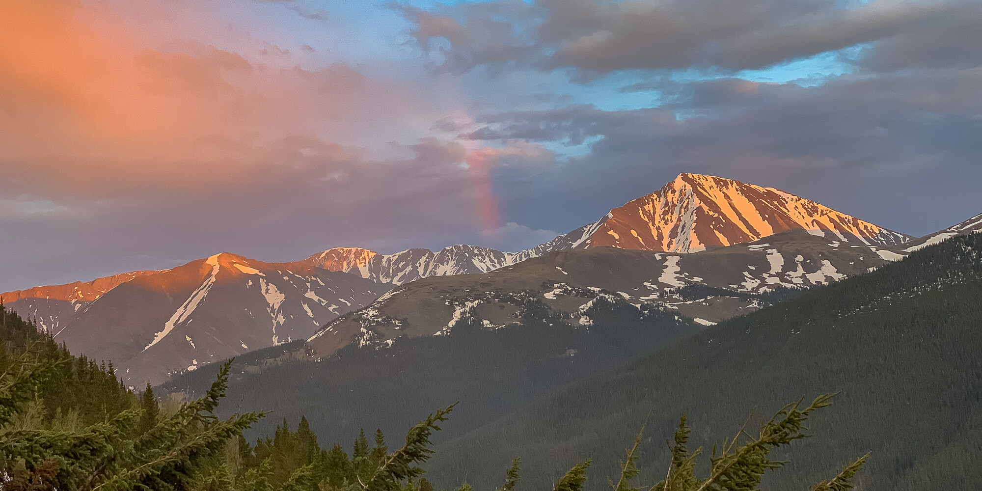
Along the way, I was treated once again to commanding and expansive views of the region’s colorful geology.
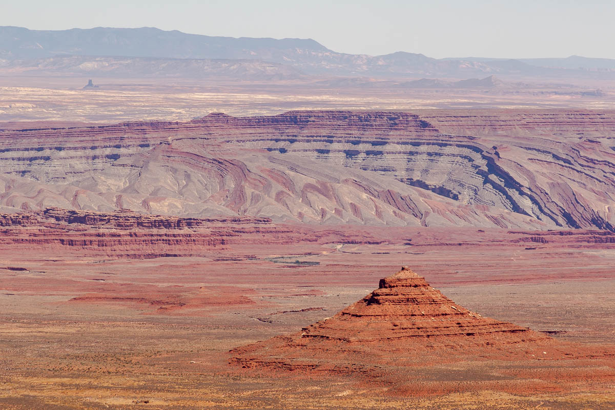
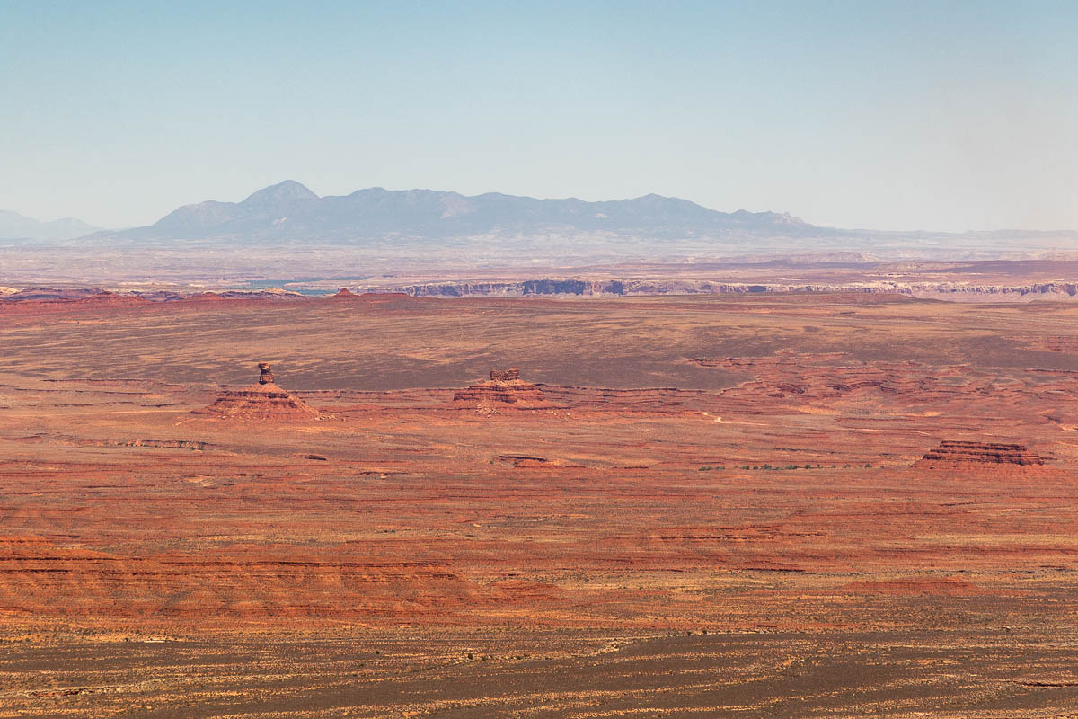
My plan was to camp in Valley of the Gods, a collection of sandstone buttes and rock formations that many have likened to a little Monument Valley. In the shot below, the large range in the distance is Sleeping Ute Mountain (aka Ute Mountain), named for the profile’s resemblance to a person lying down.
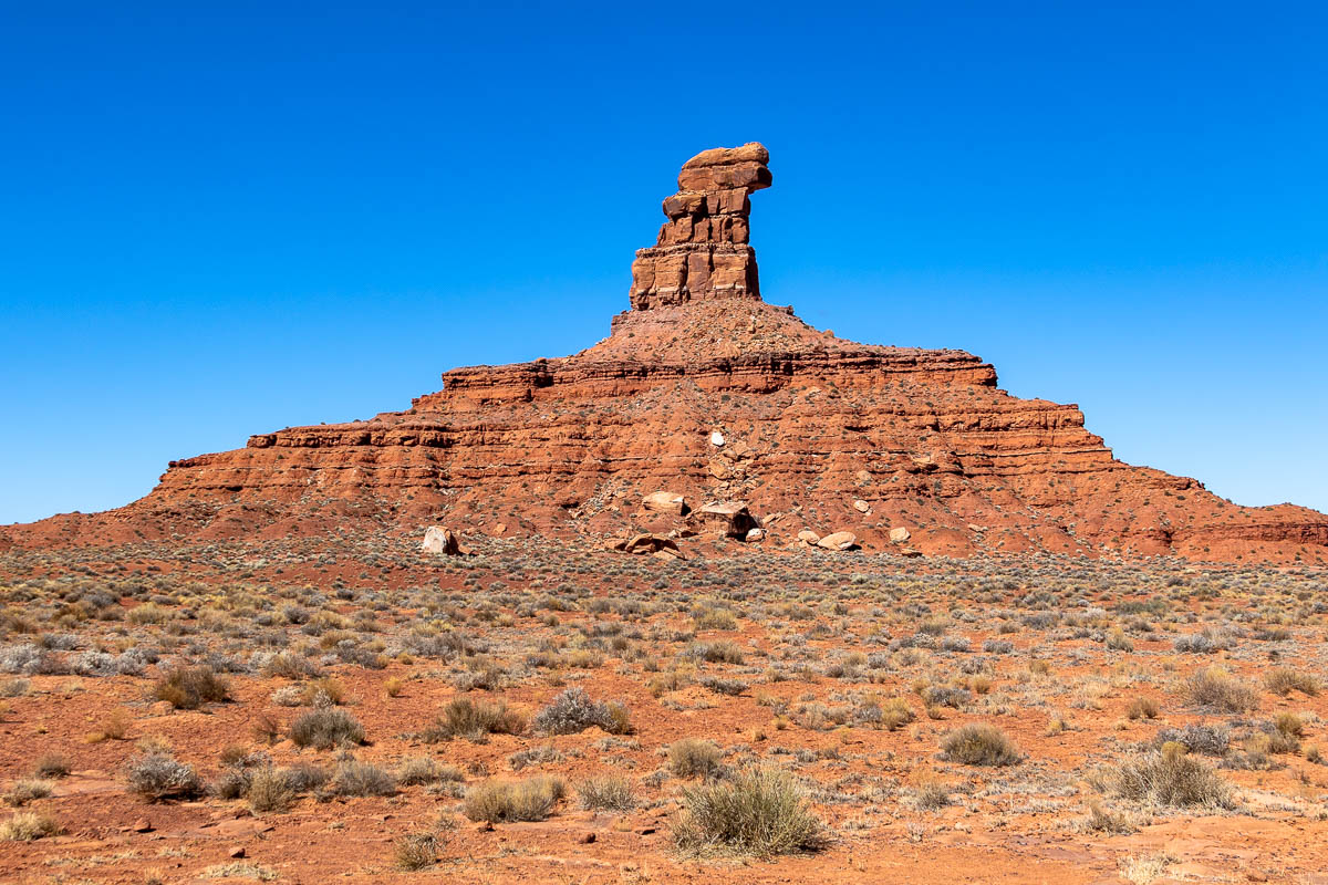
I didn’t know it at the time I shot the above photo, but I would wind up camping right at the base of the leftmost butte in the frame: Battleship Rock.
A fun part of the drive to Mexican Hat was descending the Moki Dugway. What’s a dugway? It’s basically an excavated road on a steep slope—one dictionary defines it more narrowly as a “road constructed along a hillside by using for the fill on the downhill side material excavated immediately above.” Think extreme grades, lots of switchbacks, and a gravelly road surface. And don’t confuse it with the Dugway Proving Ground, a chemical and biological weapons testing area in another part of Utah.
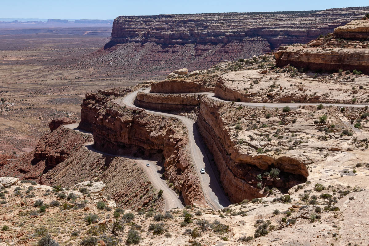
The descent wasn’t any challenge for the 4Runner and I even saw some 2WD rental cars making the climb ever so slowly.
Aside from the marvel of the engineering, the route offered some great views of Southeast Utah. I thought about spinning up the drone for a quick flight, but the light was meh so I opted to save my batteries.
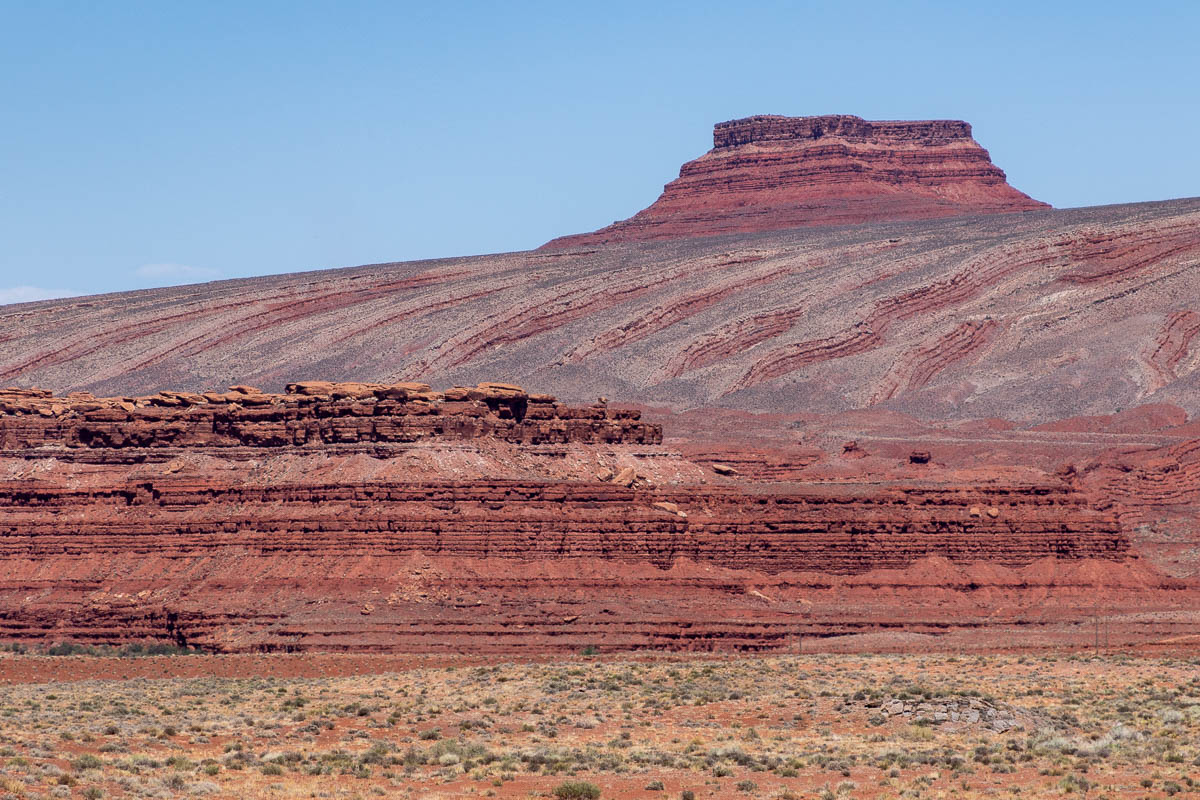
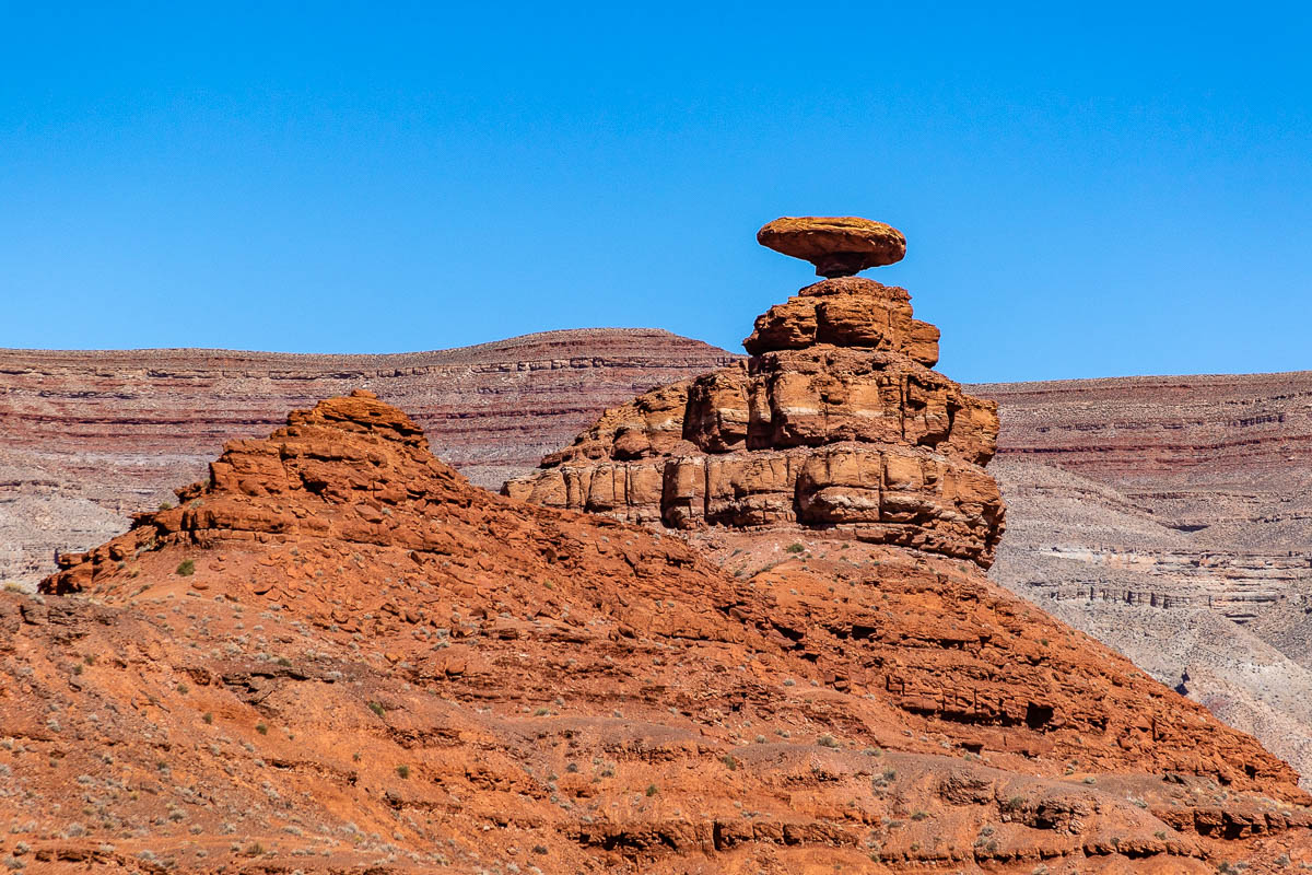
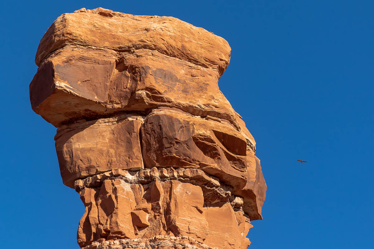
I was starting to run low on fuel for the SUV, but when I reached Mexican Hat, its namesake shown below, the pumps at the sole gas station in town were out of commission due to some computer problem. D’oh!
Fortunately, I wasn’t totally down to empty, but I decided to stop for lunch and try again later. After a tasty burrito at one of the few places open in town, I drove to the station again but there was still no gas.
The best option was to drive to 25 miles down the road to Bluff for fuel and then double-back to the Valley of the Gods to find a place for the night.
There were a few people who’d already laid claim to some choice camping spots, but as I drove deeper into the valley, I started to see plenty of options and eventually settled on Battleship Rock.
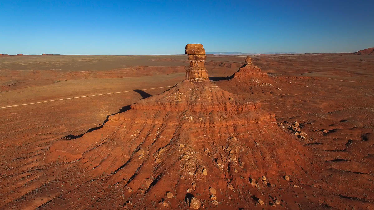
The sky was crystal clear and the late afternoon light was gorgeous. Before sunset, I did a drone flight and had a blast navigating around the butte.
Below is a still photo of the butte—one of my favorite images from the trip and one of the best shots I’ve taken with my drone!
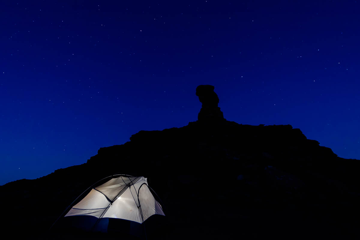
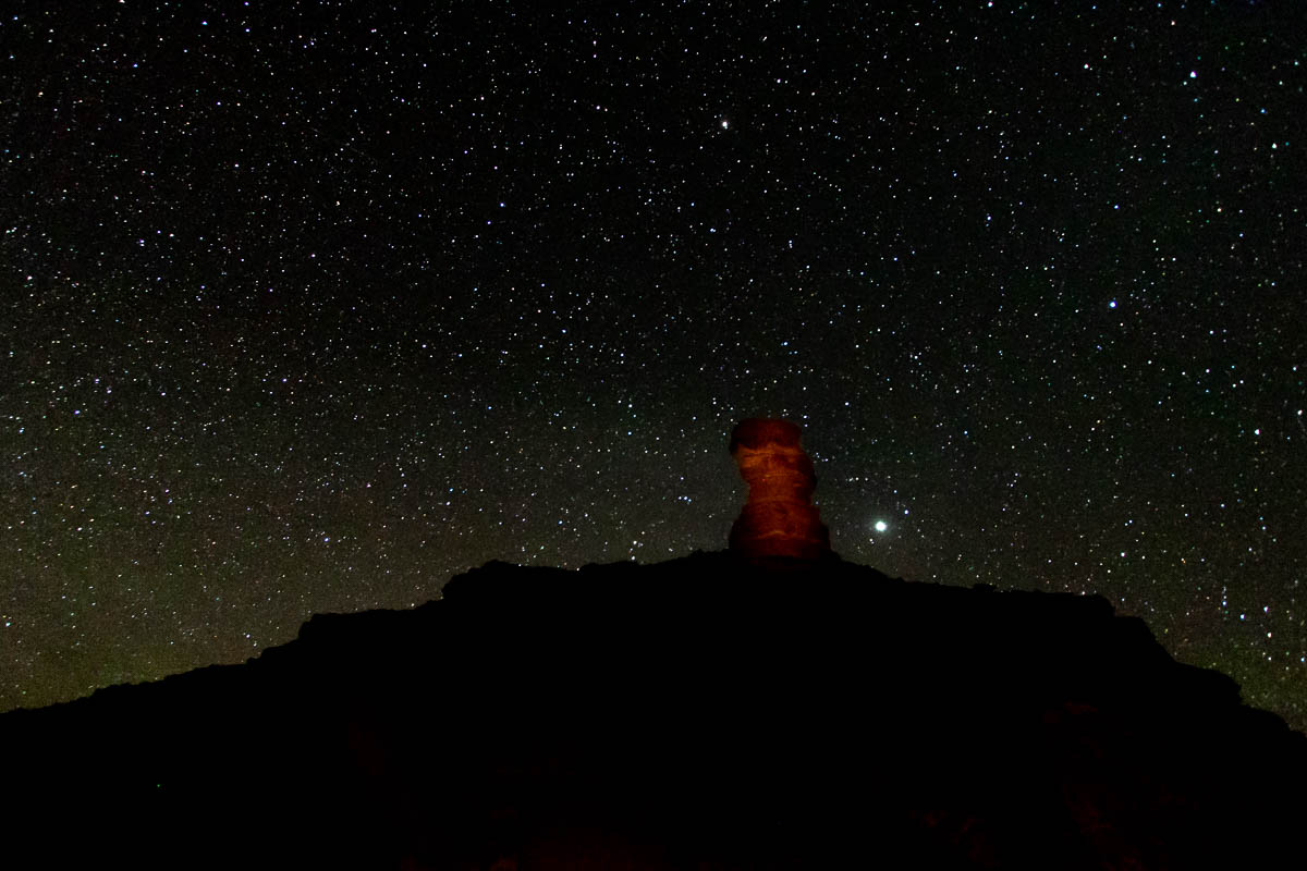
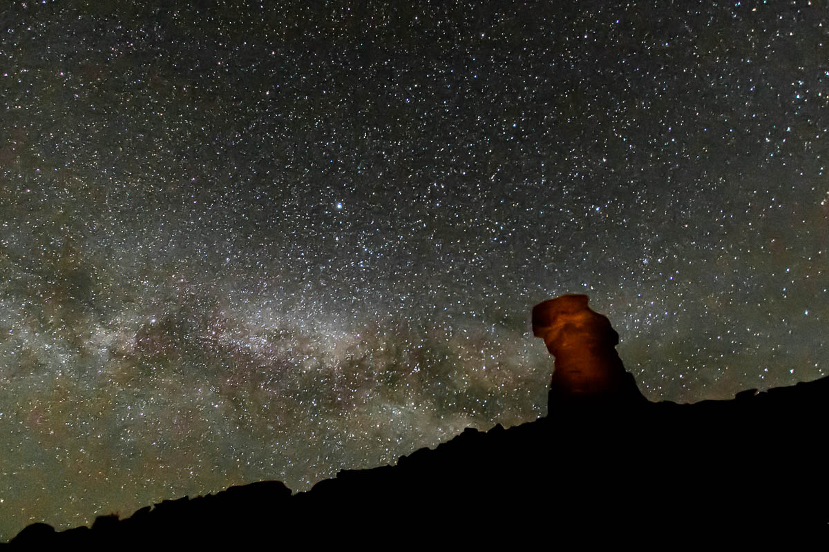
Once it got dark, I set up my camera with hopes of capturing the starscape behind a silhouette of the butte.
Then I decided to play around with illuminating the butte using a flashlight. It took a while to get the settings right, but overall I was happy with my experiment. Below is a slideshow of some images from the night.

I didn’t get to bed until nearly 2 a.m., but the late night was well worth it.
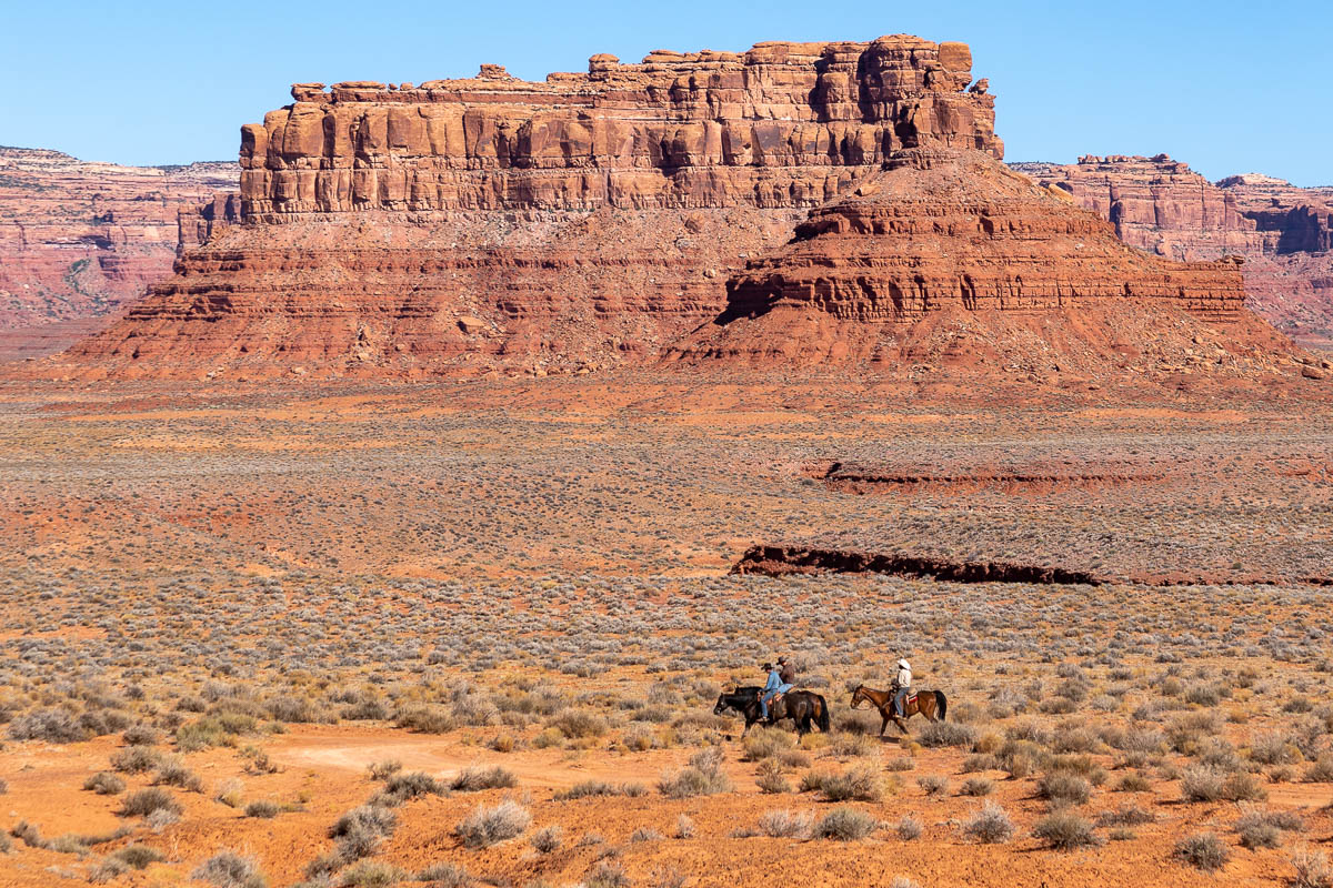
The next morning, as I was packing up, I saw some cowboys riding in the distance. The Valley of the Gods was removed from Bears Ears National Monument by the Trump administration, but my understanding of the original designation is that existing grazing was grandfathered into the monument.
On my way out of the Valley of the Gods, I shot some more photos of Battleship Butte. From the other side, the monument looked even more like its namesake.
The next stop on my road trip was Canyonlands National Park and a special hike I’d always wanted to tackle . . .
This post is part of a series on my May 2018 trip to Southeast Utah. Check out the rest:
- Day 1: Goblin Valley State Park photos
- Camp 1: Little Flat Top drone flights and video
- Day 2: Dirty Devil and Lake Powell Overlooks
- Camp 2: Bears Ears National Monument photos
- Day 3: Valley of the Gods photos
- Day 4: Canyonlands National Park confluence hike
- Camp 4: Finding my North Star in the Abajo Mountains
- Day 5: Colorado River drone footage near Moab, Utah
[…] departing the Valley of the Gods, I set off for the Needles District of Canyonlands National […]