The theme of Day 2 of my Utah road trip was overlooks: big, sweeping vistas of desert, canyons, and rivers wending their way through the arid region.
I took the drone for a spin near the Dirty Devil River, and I made plenty of photo pit stops en route to a Lake Powell overlook.
I’ve taken periodic road trips to Southern Utah for nearly a quarter-century and the region always blows me away. It’s a photographer’s paradise.
Dirty Devil drone flight
My first stop on this day was a remote overlook of the Dirty Devil River, an 80-mile tributary to the Colorado that was named by explorer John Wesley Powell during his famed 1869 expedition. The Dirty Devil isn’t exactly a roaring river, but much of its journey is through a serpentine canyon that’s up to 2,000 feet deep.
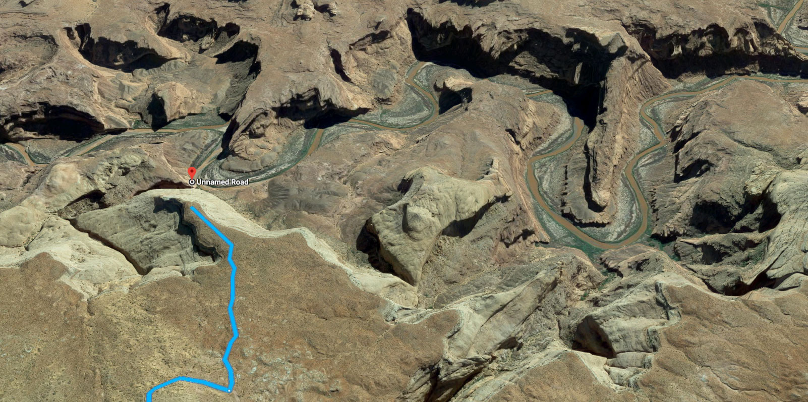
While scouting for my road trip, I noticed the landscape while I was playing around with Google Maps and its amazing 3-D satellite view. I was looking for places with interesting topography and came across this remote part of the Burr Desert.
I’m a fan of gazetteers, but Google Maps is tough to beat when it comes to pre-visualizing a potential photo/video location. The 3-D mode is especially helpful if you’re trying to imagine what aerial footage will look like.
I made my way to the overlook on some dusty dirt roads. At the overlook, I found a young couple who were camped there and I asked if it were OK for me to fly my drone nearby.
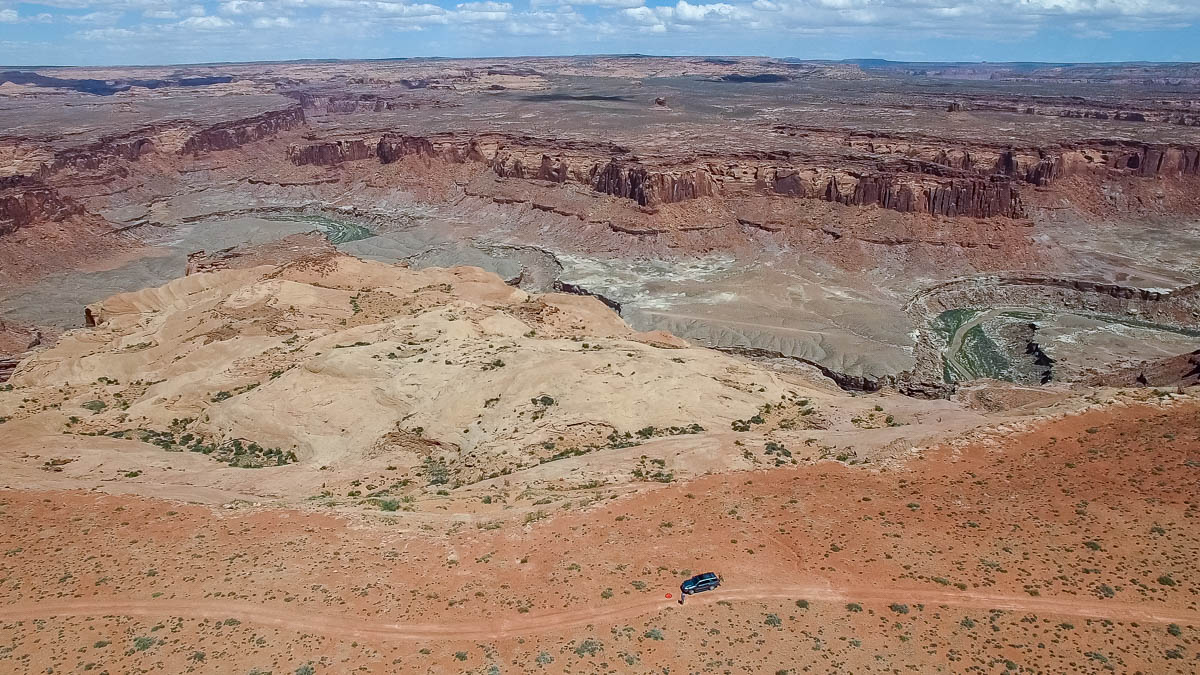
Once airborne, here’s what the view looked like:
The location didn’t quite live up to my expectations because I thought the canyon would drop off more precipitously. I was hoping to shoot some footage in which I would fly quickly off the edge of the canyon and then suddenly be above a yawning chasm that would inspire vertigo. In reality, the canyon stair-stepped down from the rim to the floor and the Dirty Devil River.
The other challenge was the stiff wind, which made it hard to keep my drone stationary or shoot smooth video. I also feared venturing too far out into the canyon because I had to fight the headwind to get back to my landing spot.
Nevertheless, it was a fun place to fly and I wound up getting some decent footage. Some highlights from the flights are in this video that I posted to my Vimeo page:
From the Dirty Devil overlook, I set off back through the Burr Desert to get back on blacktop. I had a bunch of driving to do, although I wasn’t quite sure where I was headed.
On the Road
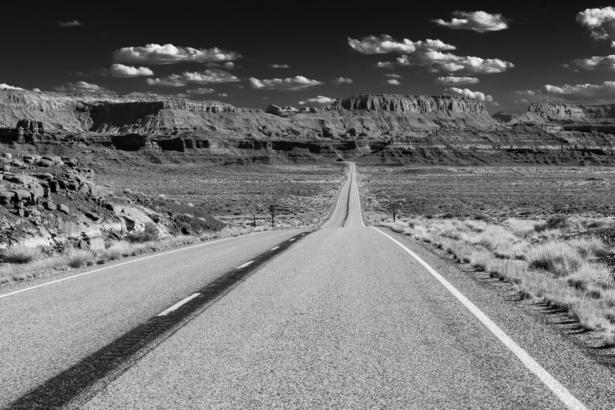
Along the way, I found some sweeping vantage points for photos. The region has plenty of empty spaces and I was able to just sit in the middle of the road for five minutes while composing the shot below, which I call “On the Road (or Life is a Highway).”
Lake Powell overlook
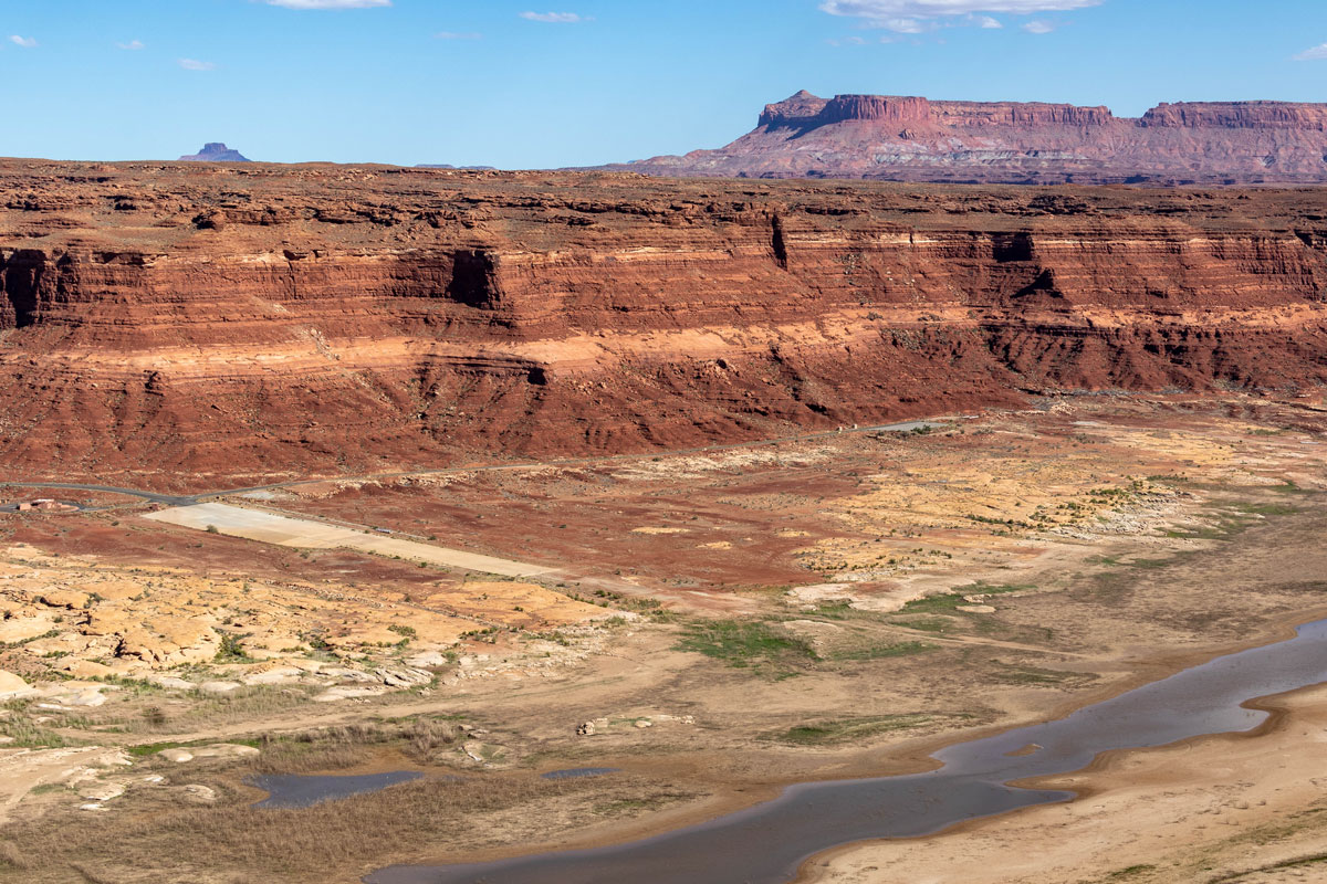
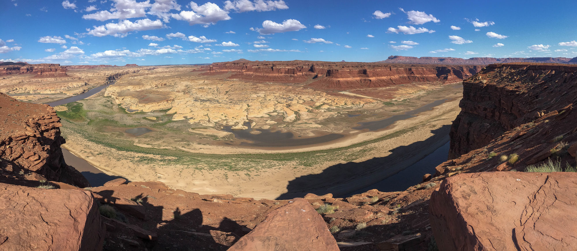
Eventually, I made my way to an overlook of the Colorado River and the start of Lake Powell, near the one-time site of the Hite Marina. Due to long-term drought and growing human demands on the Colorado River, it’s been many years since the Hite Marina was a viable launching spot for boats. As you can see in the photo below, the boat ramp is now a long ways from the water.
Below is another shot from the same Lake Powell overlook, showing the Colorado River coming in on the left. Much of my work over the past few years has revolved around Colorado River issues, in particular serving as an independent evaluator of philanthropic grantmaking related to the river, so it’s always nice to see the thing in person. I’m always amazed by how small the river looks in relation to both the canyons it has carved and the size of the population now dependent on its flows: about 40 million.
When the seven states in the Colorado River Basin divvied up the flow with a 1922 compact, and when Lake Powell started to fill in 1963 with the completion of Glen Canyon Dam, water managers were relying on overly generous estimates of the Colorado River’s flow. Now, with climate change already shrinking the river further, it’s looking less and less likely that Hite Marina will ever open again.
The view from the Lake Powell overlook was especially stark for me because the last time I was in this very remote corner of the West, during a spring road trip in 1996, the reservoir was nearly full.
If you’d like to learn more about the Colorado River and see satellite images of the Hite Marina area, see this piece I wrote a while ago on EcoWest.org, a site I developed as part of my work with the David and Lucile Packard Foundation.
This post is part of a series on my May 2018 trip to Southeast Utah. Check out the rest:
- Day 1: Goblin Valley State Park photos
- Camp 1: Little Flat Top drone flights and video
- Day 2: Dirty Devil and Lake Powell Overlooks
- Camp 2: Bears Ears National Monument photos
- Day 3: Valley of the Gods photos
- Day 4: Canyonlands National Park confluence hike
- Camp 4: Finding my North Star in the Abajo Mountains
- Day 5: Colorado River drone footage near Moab, Utah
Mitch Tobin
Mitch Tobin is an author, multimedia journalist, and FAA-certified drone pilot based in Durango, Colorado.
Related Posts
2 Comments
Comments are closed.
[…] Day 2: Dirty Devil and Lake Powell Overlooks […]
[…] Day 2: Dirty Devil and Lake Powell Overlooks […]